Tuesday, September 27, 2022

Enchantments Day Hike (2022 Version)


The Enchantments live up to their name. One of the jewels of the Alpine Lakes Wilderness in the Cascade Mountains in Washington, the Enchantments boast dozens of pristine lakes surrounded by numerous craggy peaks. Because too many people damage the fragile ecosystem of the area, camping requires winning the permit lottery...and the odds aren't good. Without a permit, the best option for seeing the core Enchantments involves hiking 20+ miles in a day. According to my Garmin, the route involves nearly 6000' ascent and around 8000' descent. Punishing hike, but so worth the struggle.

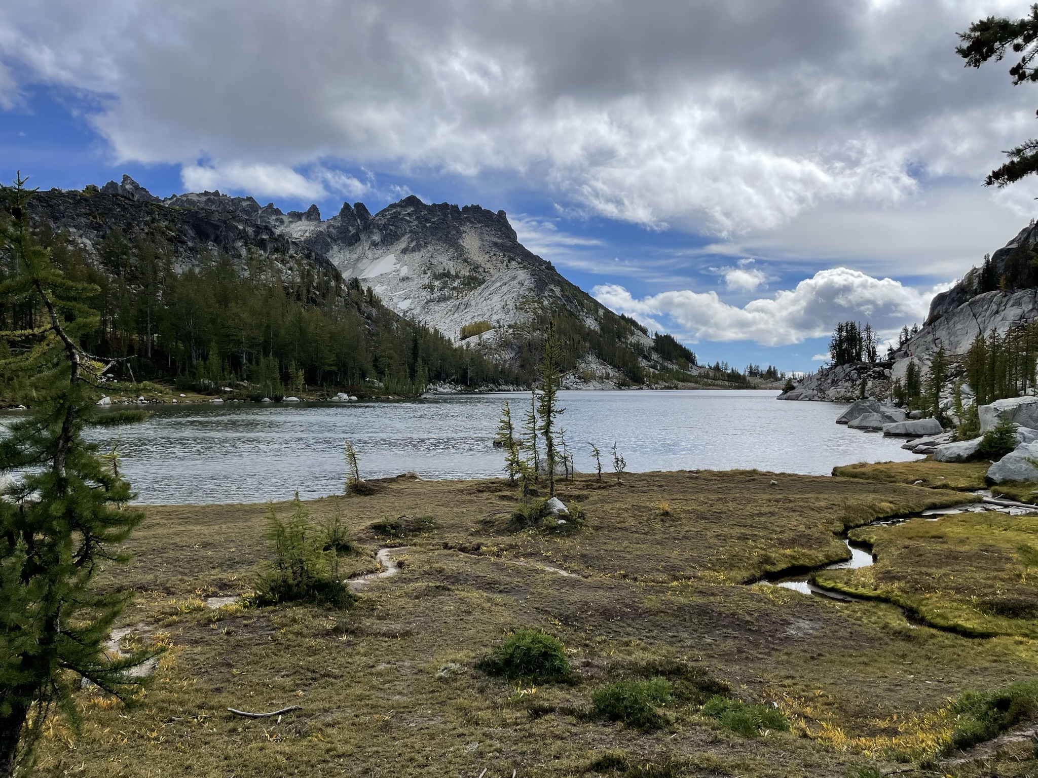
Colchuck Lake with views of Dragontail, Aasgard Pass and Colchuck Peak

Larches just beginning to turn near Colchuck Lake

Reflection of Aasgard Pass and the peaks

We started from the Stuart Lake Trailhead at 6:00am, hiking under the stars until sunrise. A 4-mile hike leads to Colchuck Lake, with views of Dragontail Peak, Aasgard Pass and Colchuck Peak.

Colchuck from the south end

After hiking around Colchuck, we headed up the rocks to Aasgard Pass. The rock scramble up Aasgard is a challenge, with 2000' elevation gain in around 1.5 miles. But the views at every step help.

Dragontail Peak with larches

Cairns mark the trail throughout the Enchantments

Colchuck Lake from the rock scramble to Aasgard Pass

Waterfall on the way up to Aasgard Pass

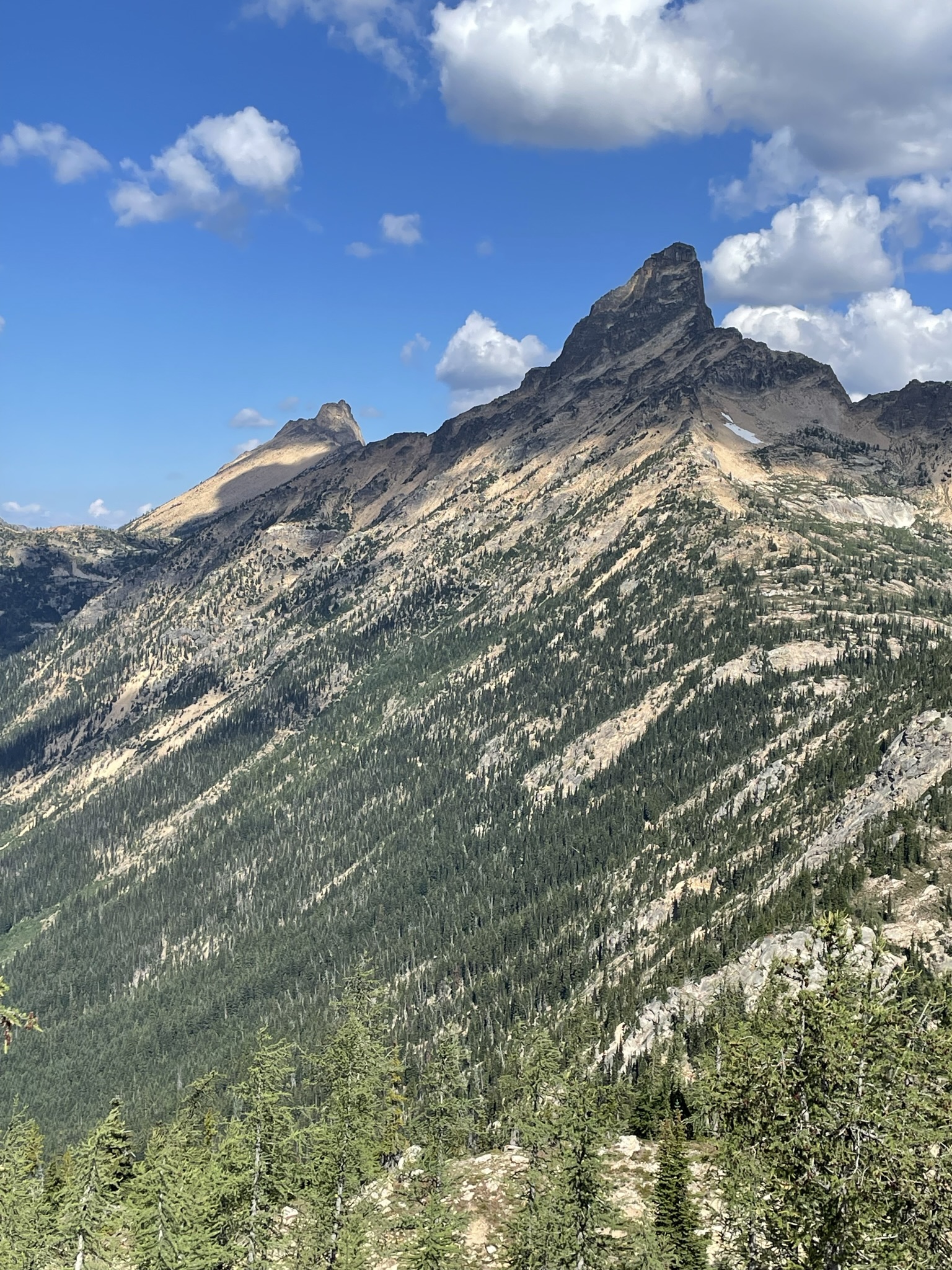
Peak to the left of Aasgard Pass 

Near the top, we stopped at Tranquil Lake, an initial glorious intro to the lakes ahead.
A little yoga at Tranquil Lake seemed appropriate

Tranquil Lake

After a few moments soaking in the view from Aasgard, we made our way to our favorite lunch spot at Isolation Lake.

Aasgard Pass

Isolation Lake

Leaving Isolation Lake

From Isolation, the trail winds past numerous crystal clear lakes and streams, with views of Little Annapurna, McClellan Peak, Prusik Peak, The Temple and more. (This is a rock climber's paradise.)


Probably Crystal Lake

Perfection Lake


Prusik Peak

Probably Lake Viviane

We saw a bit of wildlife along the way, from a pine marten at Colchuck to goats at the top and our chipmunk friend.

Pine marten

Goats with Little Annapurna in the background


We hiked the exact weekend that we hiked Enchantments last year. But autumn is taking its time this year, and the color difference was striking.

September 24, 2021 and September 23, 2022

In spite of good intentions to shave an hour or two off last year's time, we dawdled in the lakes taking photos and found ourselves mid-afternoon with nearly 10 miles of punishing downhill to go. Thank goodness for headlamps! Snow Lake has dropped even lower than last year, but Nada Lake was just as peaceful as I remember. Once dark descended, we hiked along Snow Creek to the trailhead, counting all 24 switchbacks after the parking lot came into view.

Snow Lakes from above

We did see a little color, but not like last year

Snow Lake

Nada Lake

Nada Lake

The adventurers: Jamie Gunter, Nicole Skeem and me


Saturday, August 27, 2022

North Cascades 2022 - Harts Pass to Rainy Pass

Lower Snowy Lake

This year, for the annual backpacking trip with my trail running friends, we explored another section of the Pacific Crest Trail, this time from Harts Pass to Rainy Pass. 31 miles from pass to pass, plus a short warmup hike north of Harts Pass and a detour just off the trail to Snowy Lakes, which was spectacular and a highlight of the trip. 

The PCT is a beautifully maintained trail, for the most part. And it offers quite a bit of variety in a relatively few miles. As a bonus, we met dozens of thru hikers from all over the world completing the last couple of days of their 2,650-mile hike from Mexico. 

View from road to Harts Pass

View from below Slate Peak, north of Harts Pass

Our shuttle dropped us off at Harts Pass late Monday afternoon. (Shout out to Wes and his crew at Methow Motion Shuttle!) Harts Pass and the nearby Meadows Campground offer great camping spots. As it happens, we were the last folks who made it up the already treacherous Harts Pass road before a mudslide made it impassable. 

View from trail approaching Tatie Peak

Handcock Ridge from trail approaching Tatie Peak


View northwest from unnamed pass near Tatie Peak

Tuesday morning, we headed south toward Brush Creek (13 miles with no water sources, so bring plenty). 3 miles or so south of Harts Pass, we crossed an unnamed but stunning pass with views of the Handcock Ridge to the south, and likely Robinson and other mountains to the northeast. From there, the trail hugged the mountainside for another four miles to our lunch spot a couple of miles beyond Tatie Peak, with spectacular views all along the way. 

Azurite Peak and Mount Ballard

Lunch with a view

Switchbacks going down to Glacier Pass

View from trail between Glacier Pass and Brush Creek

We ate lunch on a cliff with front row seats to Azurite Peak and Mt. Ballard before beginning the 6-mile descent to Brush Creek. Rain started midway down the roughly two miles of switchbacks to Glacier Pass (which is really just an unremarkable spot in the middle of a forest). After the switchbacks, the trail descends through forest for a couple of miles, then parallels Brush Creek. Between the rain and the mile or two of bushes covering the trail, we arrived at Brush Creek camp (at the junction of the PCT and the Methow River Trail) soaked. Brush Creek has a great water source but is otherwise a rather disappointing camp with few good campsites.

Methow River

Trail to Methow Pass

Mt. Hardy from trail to Methow Pass

Thankfully, Wednesday morning brought sunshine. After a gently rolling 3 miles through brush and forest, we arrived at the Methow River crossing and Willis Camp (which is lovely). From the river, the trail climbs steadily for five mostly-forested miles to Methow Pass. Although there were hundreds of trees down in the forest, the trail is in great condition.

From trail below Methow Pass

From trail below Methow Pass

Looking down at camp at Lower Snowy Lake

Camp at Lower Snowy Lake

Upper Snowy Lake with Tower Mountain in background

After lunch at Methow Pass, we headed down the trail for a mile to the junction at Snowy Lakes, another cliff-hugging trail with magnificent views. The camp at the junction is lovely, but we headed up a half mile to a much better site at Snowy Lakes. The lower lake sits under Tower Mountain and Golden Horn and overlooks a vast panorama of mountains. A short hike leads to the upper lake, with views of Azurite Peak and other mountains to the north and west. We had the lakes to ourselves for a beautiful, peaceful night.

Golden Horn reflected in Lower Snowy Lake

Looking out over Azurite Peak, Methow Pass, Tower Mountain

Golden Horn and Tower Mountain

From trail up to Cutthroat Pass

View north from Cutthroat Pass

View south from Cutthroat Pass

Thursday, we hiked from Snowy Lakes to Rainy Pass (roughly 9.5 miles). The trail heads down for a mile or two before climbing steeply up to Granite Pass and then Cutthroat Pass. No significant water between Snowy and Cutthroat, but plenty of eye candy. From Cutthroat, we descended the final 5 miles through mostly forest to Rainy Pass. Unlike the trail higher up, this section boasted plentiful water sources, including the lovely Porcupine Creek just a mile or two above Rainy Pass.

Trail from Cutthroat Pass to Rainy Pass

Porcupine Creek


The Muddy Buddies at Cutthroat Pass