 |
| Lower Snowy Lake |
This year, for the annual backpacking trip with my trail running friends, we explored another section of the Pacific Crest Trail, this time from Harts Pass to Rainy Pass. 31 miles from pass to pass, plus a short warmup hike north of Harts Pass and a detour just off the trail to Snowy Lakes, which was spectacular and a highlight of the trip.
The PCT is a beautifully maintained trail, for the most part. And it offers quite a bit of variety in a relatively few miles. As a bonus, we met dozens of thru hikers from all over the world completing the last couple of days of their 2,650-mile hike from Mexico.
 |
| View from road to Harts Pass |
 |
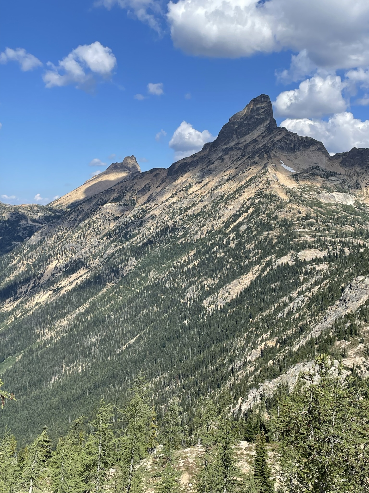
| View from below Slate Peak, north of Harts Pass |
Our shuttle dropped us off at Harts Pass late Monday afternoon. (Shout out to Wes and his crew at Methow Motion Shuttle!) Harts Pass and the nearby Meadows Campground offer great camping spots. As it happens, we were the last folks who made it up the already treacherous Harts Pass road before a mudslide made it impassable.
 |
| View from trail approaching Tatie Peak |
 |
| Handcock Ridge from trail approaching Tatie Peak |
 |
| View northwest from unnamed pass near Tatie Peak |
Tuesday morning, we headed south toward Brush Creek (13 miles with no water sources, so bring plenty). 3 miles or so south of Harts Pass, we crossed an unnamed but stunning pass with views of the Handcock Ridge to the south, and likely Robinson and other mountains to the northeast. From there, the trail hugged the mountainside for another four miles to our lunch spot a couple of miles beyond Tatie Peak, with spectacular views all along the way.
 |
| Azurite Peak and Mount Ballard |
 |
| Lunch with a view |
 |
| Switchbacks going down to Glacier Pass |
 |
| View from trail between Glacier Pass and Brush Creek |
We ate lunch on a cliff with front row seats to Azurite Peak and Mt. Ballard before beginning the 6-mile descent to Brush Creek. Rain started midway down the roughly two miles of switchbacks to Glacier Pass (which is really just an unremarkable spot in the middle of a forest). After the switchbacks, the trail descends through forest for a couple of miles, then parallels Brush Creek. Between the rain and the mile or two of bushes covering the trail, we arrived at Brush Creek camp (at the junction of the PCT and the Methow River Trail) soaked. Brush Creek has a great water source but is otherwise a rather disappointing camp with few good campsites.
 |
| Methow River |
 |
| Trail to Methow Pass |
 |
| Mt. Hardy from trail to Methow Pass |
Thankfully, Wednesday morning brought sunshine. After a gently rolling 3 miles through brush and forest, we arrived at the Methow River crossing and Willis Camp (which is lovely). From the river, the trail climbs steadily for five mostly-forested miles to Methow Pass. Although there were hundreds of trees down in the forest, the trail is in great condition.
 |
| From trail below Methow Pass |
 |
| From trail below Methow Pass |
 |
| Looking down at camp at Lower Snowy Lake |
 |
| Camp at Lower Snowy Lake |
 |
| Upper Snowy Lake with Tower Mountain in background |
After lunch at Methow Pass, we headed down the trail for a mile to the junction at Snowy Lakes, another cliff-hugging trail with magnificent views. The camp at the junction is lovely, but we headed up a half mile to a much better site at Snowy Lakes. The lower lake sits under Tower Mountain and Golden Horn and overlooks a vast panorama of mountains. A short hike leads to the upper lake, with views of Azurite Peak and other mountains to the north and west. We had the lakes to ourselves for a beautiful, peaceful night.
 |
| Golden Horn reflected in Lower Snowy Lake |
 |
| Looking out over Azurite Peak, Methow Pass, Tower Mountain |
 |
| Golden Horn and Tower Mountain |
 |
| From trail up to Cutthroat Pass |
 |
| View north from Cutthroat Pass |
 |
| View south from Cutthroat Pass |
Thursday, we hiked from Snowy Lakes to Rainy Pass (roughly 9.5 miles). The trail heads down for a mile or two before climbing steeply up to Granite Pass and then Cutthroat Pass. No significant water between Snowy and Cutthroat, but plenty of eye candy. From Cutthroat, we descended the final 5 miles through mostly forest to Rainy Pass. Unlike the trail higher up, this section boasted plentiful water sources, including the lovely Porcupine Creek just a mile or two above Rainy Pass.
 |
| Trail from Cutthroat Pass to Rainy Pass |
 |
| Porcupine Creek |
 |
| The Muddy Buddies at Cutthroat Pass |


such incredible beauty! xx
ReplyDelete