|
| From the summit of Eagle Cap |
For years, I have driven I-84 between Oregon and Utah, gazing longingly at the Wallowa Mountains. I finally convinced my friend Sheri Sinclair to join me, and we spent an all-too-short 3 1/2 days backpacking in the Eagle Cap Wilderness.
In the middle of the hike, we stood on the summit of Eagle Cap Mountain, gazing across a 360 degree view of mountains and lakes to explore. This trip, we hiked along the West Fork of the Wallowa River and through the Lakes Basin, then took a side trip up Eagle Cap before heading over Glacier Pass to Glacier Lake and Frazier Lake, hiking down the West Fork trail to 6-Mile Meadow and back to Wallowa Lake.
Day 1: Wallowa Lake to Lee Lake
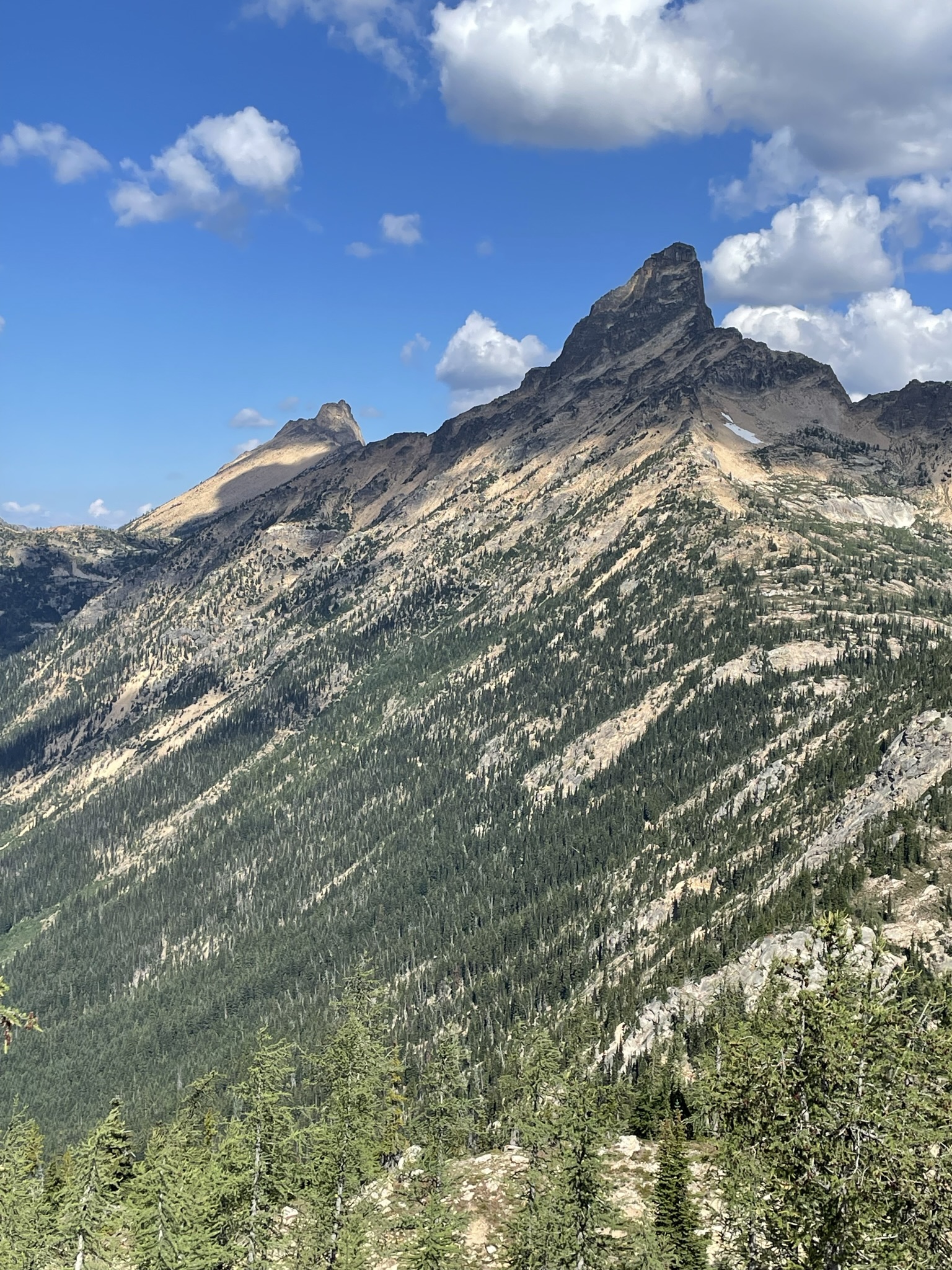
 |
| 6-Mile Meadow |
10 miles, 2500' elevation gain
For our first Wallowa adventure, we decided to try a classic hike, beginning with the West Fork Wallowa River Trail (trail #1820) from Wallowa Lake. After six miles of gradual ascent along the Wallowa River, we turned off onto the Lakes Basin trail at 6-Mile Meadow. The trail along the river is lovely, but it pales in comparison to the back country.
 |
| Horseshoe Lake |
From the river crossing at 6-Mile Meadow, we headed up to Horseshoe Lake, then on to our campsite at Lee Lake. In spite of the popularity of this area, we saw only 20 or so other hikers all day and shared the lake with just two other people.
 |
| Camping at Lee Lake |
Day 2: Lee Lake to Moccasin, Side Trip to Eagle Cap
Almost 10 miles, 2500' up, 2100' down
 |
| Approaching Moccasin Lake |
After a rainy, windy night, we headed deeper into the Lakes Basin, passing Douglas Lake and setting up camp at beautiful Moccasin Lake. We found a secluded campsite nestled in the rocks between sections of the lake and dropped our heavy packs before heading up to the summit of Eagle Cap (a must-do side trip for this section of the Wallowas).
 |
| Mirror Lake and Eagle Cap |
The trail to Eagle Cap passes by stunning Mirror Lake. Situated at the hub of several trails leading to Eagle Cap, the Lostine River, East Eagle, Ivan Carper, Minam Lake, Horton Pass and the Lakes Basin, Mirror Lake sees substantial traffic. Surprisingly, the rocks and forest surrounding the lake handle the people (and horses and dogs) well, and the area manages to retain a peacefulness (at least mid-week).
 |
| Eagle Cap from Horton Pass |
From Mirror Lake, we took the Eagle Cap trail to climb past Upper Lake and Horton Pass. The trail climbs 2000 feet in 2 miles, and there are few trees along the way. Consequently, every turn gave us a stunning view. At 9572' elevation, Eagle Cap is slightly lower than Sacajawea and Matterhorn Peaks to the north, but it delivers unparalleled views in all directions.
 |
| Glacier Lake and Glacier Peak from Eagle Cap |
In addition to majestic Matterhorn and the Lostine River valley, Mirror and Moccasin Lakes and so many mountains and lakes unknown to me, the summit looks directly down on Glacier Lake and Glacier Peak.
After nearly an hour with the summit to ourselves, we headed back down to Moccasin Lake and a delightfully serene evening. A nearly full moon peaked through my tent window midway through the night. obscuring the stars somewhat but lending an extra touch of magic to an already dreamy day.
 |
Moccasin Lake from trail to Mirror
 | | Campsite at Moccasin |
|
 |
Eagle Cap from just below our campsite
|
Days 3 and 4: Moccasin to Glacier Lake, Frazier Lake, 6-Mile Meadow and Wallowa Lake
Day 3: 9 miles, 1000' up and 1400' down
Day 4: 6 miles, 1400' down
 |
| Moccasin Lake |
 |
| Moccasin Lake |
We took our time leaving camp, reluctant to move on, but we had a great day ahead. The hike up to Glacier Pass wound along a steep, rushing creek for a while and left me constantly scrambling for my phone to capture views of the lakes below and Matterhorn to the north. From windy Glacier Pass, we dropped down to our lunch spot at Glacier Lake. Situated in a bowl under Glacier Peak and Eagle Cap, Glacier Lake spills over the edge to send a rushing creek down the valley to Frazier Lake.
 |
| Matterhorn from trail to Glacier Pass |
 |
Glacier Lake from Glacier Pass
|
 |
| Rock and flower art |
 |
Approaching Frazier Lake
|
Just before Frazier, the trail winds through a forest. Following a little side trail, we stumbled on a waterfall, checking yet another off our list of musts for a perfect hike. Frazier Lake sits in a quiet meadow at the junction with the West Fork Wallowa River trail, which we would take back to 6-Mile Meadow and on to Wallowa Lake.
 |
| Waterfall near Frazier Lake |
Just below Frazier Lake, a waterfall tumbles down the cliffs to join the Wallowa River, our companion for the rest of the hike. About a mile from the lake, we had a river crossing. While hikers earlier in the season report a treacherous crossing, we found it quite manageable with our poles to keep us steady. And at this point we saw our first hikers since leaving Glacier Lake.
 |
Fireweed along trail
|
 |
| West Fork Wallowa |
 |
| River through 6-Mile Meadow |
From the river crossing, we hiked a fairly quick and uneventful 4 miles through forest and meadows and along the river to 6-Mile Meadow. Crowded with hikers beginning and ending their time in the backcountry, 6-Mile Meadow offered a change from the serenity of the rest of our hike. Nonetheless, we found a site for our tents and a fairly private spot in the river to wash up. After a quiet night under a full moon, we got up early, packed up and hiked an easy 6 miles back to Wallowa Lake, already planning a return trip.
 |
| With the fabulous Sheri Sinclair |